Muskoka is built on granite, and its rivers have to get over that rock on the way down to Georgian Bay. The result is a district full of waterfalls, from a cascade in the middle of a downtown to a roaring chute near the Algonquin Park border. Most of them are free, close to the road and short walks from a parking area, which makes a waterfall day one of the easiest outings in the region.
This guide covers the falls with the clearest public access and official information, starting in Bracebridge and working north. Trail details come from the Town of Bracebridge, Ontario Parks and the regional tourism board; conditions change with the seasons, so check before you go.
Why Bracebridge is the place to start
Discover Muskoka, the regional tourism organisation, calls Bracebridge "the waterfall capital of Muskoka" and notes that three of the region's best waterfalls sit within a five-minute drive of downtown. That makes the town the natural base for a waterfall loop: you can see Bracebridge Falls, Wilson's Falls and High Falls in a morning and still be back on Manitoba Street for lunch.
Bracebridge Falls, downtown
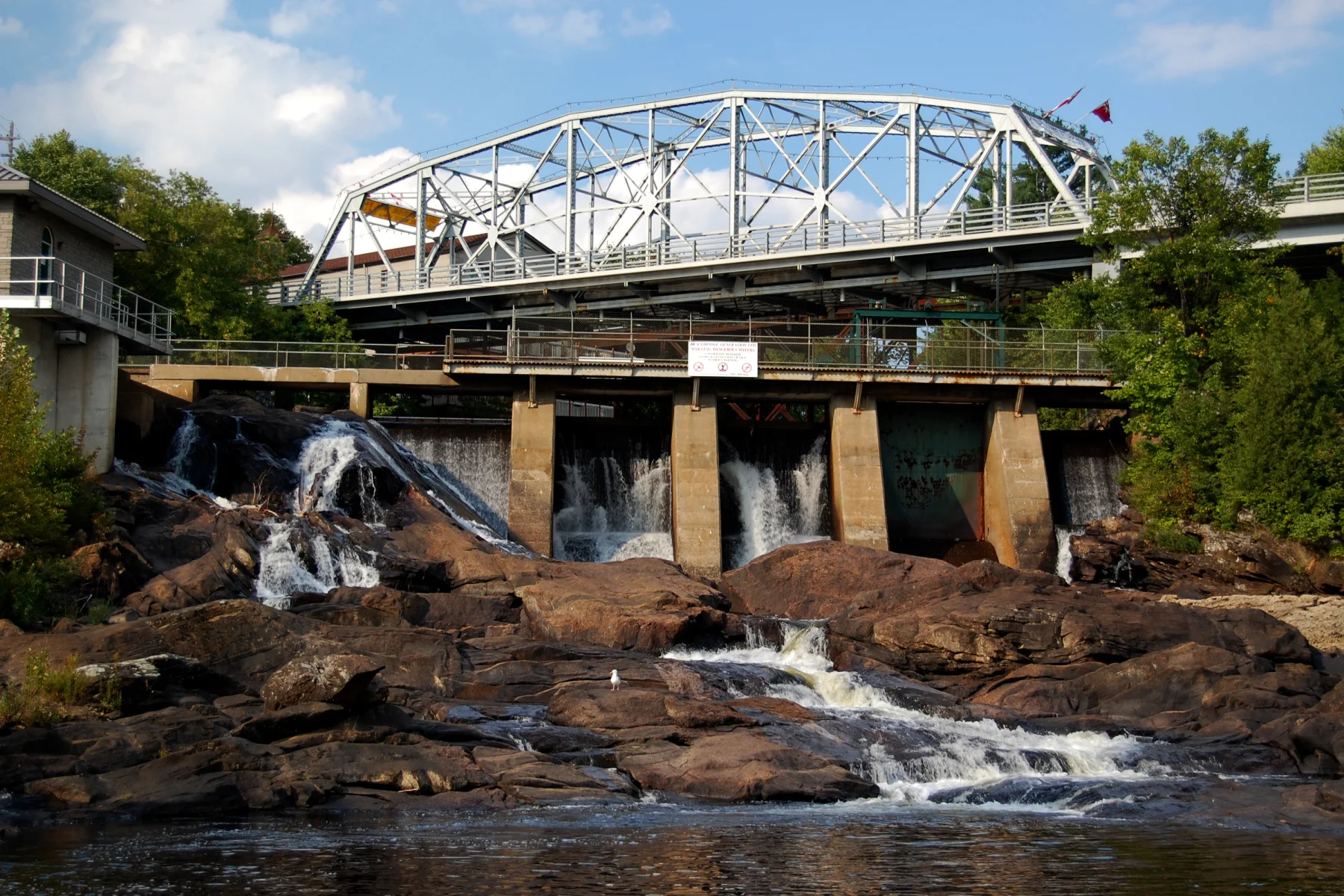
Bracebridge Falls drops through the centre of town beside the Silver Bridge. The Town's Bracebridge Bay Park at 39 Wharf Road offers a view of the falls and the bridge, and it is where the North Branch of the Muskoka River empties into Bracebridge Bay. Parking there is free. The Bracebridge Bay Trail has ten information plaques along the way, and the falls and bridge are lit at night, so it is worth a second look after dinner.
The falls are also the reason Bracebridge grew where it did. According to the Town's Heritage Walking Trail:
- A log chute was built in 1872 so logs could bypass the falls.
- Bird's Mill was built close to the falls to use the water pressure.
- In 1894 the Town bought the Bird's Mill pumping station, becoming the first municipality in Canada to own and operate a public utility of this kind.
- In 1901 a hydro-electric powerhouse with a 300-kilowatt generator was built at the foot of the falls.
In the cruising season you can also see the falls from the water. The Lady Muskoka II, run by Muskoka Cruises, offers a narrated 1.5-hour cruise on the Muskoka River from 300 Ecclestone Drive that travels to the base of the Bracebridge falls.
For a drink in the old town, Bracebridge Hall is in an early-20th-century carriage house steps from the falls. The Muskoka Way and Big River Baking Company are nearby too.
Wilson's Falls
Wilson's Falls is just north of downtown. The Town of Bracebridge lists a 3.5 km trail that winds through forest beside the North Branch of the Muskoka River, with a picnic area. The main address is 500 Wilsons Falls Road, and the Town lists several other access points, including Cedar Lane, Douglas Drive and Rodgers Road. The trail is open daily from 9 a.m. to 9 p.m., and dogs may be off-leash but must be kept under control at all times. Discover Muskoka describes Wilson's as the wildest and most scenic falls on the North Branch.
High Falls
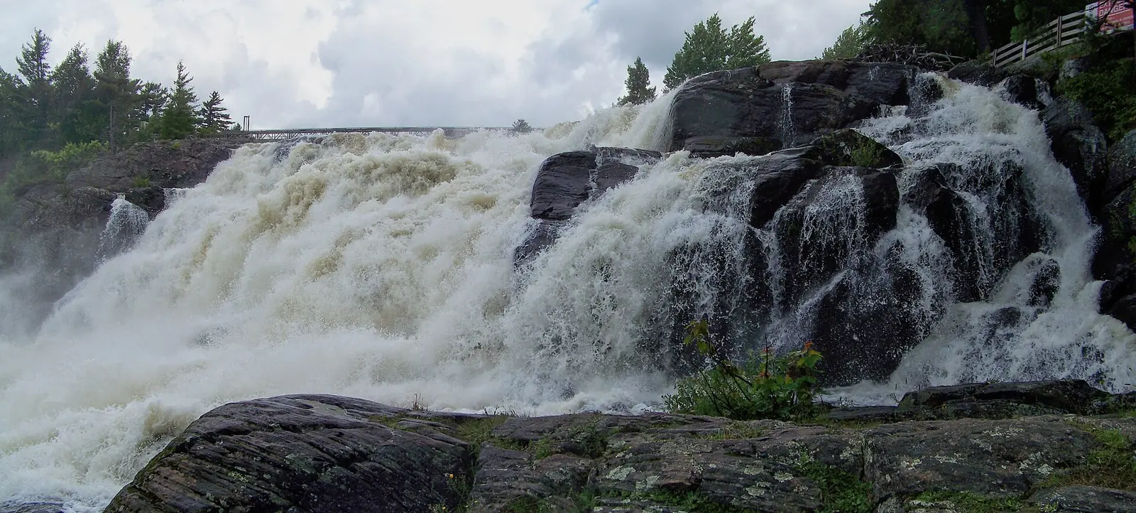
High Falls is at the Cedar Lane exit of Highway 11, on the Trans Canada Trail system. Discover Muskoka counts five waterfalls at the site: Pott's Falls, Muskoka Canyon Falls, Little High Falls, Big High Falls and a man-made fifth fall. Look for Little High Falls, sometimes called the secret waterfall, and its walking bridge, a favourite spot for family photos. Much of the site is wheelchair accessible, which makes High Falls the best choice in this guide for visitors with limited mobility.
Muskoka Falls (South Falls)
South of town is Muskoka Falls. The Town's heritage trail gives its height as 33.2 metres (109 feet) and notes that it has been called Grand, Great, South or Muskoka Falls over the years. Ontario Power Generation still operates the South Falls Generating Station here, and the river is carved into a large gorge. As at any hydro site, water levels can change quickly, so obey every fence and sign.
North of Bracebridge
Hatchery Falls, Utterson
For a quieter walk, Discover Muskoka suggests parking at the closed Skeleton Lake Fish Hatchery on Fish Hatchery Road and following a well-marked trail for about 20 minutes to Hatchery Falls. The same area has a short winter snowshoe trail with views of small waterfalls and rapids.
Stubb's Falls, near Huntsville
On the Little East River near Huntsville, Stubb's Falls is where the river slides down a rock chute. Discover Muskoka lists a 2.6 km hike and recommends it between May and October.
Ragged Falls
Ragged Falls is the most dramatic waterfall in this guide. It sits in Oxtongue River–Ragged Falls Provincial Park, off Highway 60 near Dwight and close to the West Gate of Algonquin Park. Ontario Parks says a short trail leads from the parking lot to a lookout over the whitewater, and Discover Muskoka puts the walk at roughly 1 km. A provincial park permit is required. Ontario Parks lists the park's 2026 operating season as May 8 to October 18, so treat Ragged Falls as a spring-to-autumn trip and check the park page before you go.
Nearby, Discover Muskoka notes that the Oxtongue Rapids are believed to have inspired A.Y. Jackson's painting The Red Maple.
Bala Falls
In the village of Bala, the falls are in the heart of town, close to the 4.5 km Bala Historic Walk. The river here is controlled by dams and a hydro station. Published safety guidance for the North and South Dams warns that water levels around hydro stations and dams can change quickly and with little or no warning. Obey all warning signs, fences, buoys, booms and barriers.
The river before the towns
Long before the mills and powerhouses, the Muskoka River was a travel route. The Town of Bracebridge's heritage trail notes that Muskoka was the traditional hunting grounds and homelands of many Nations, including the Anishinaabeg, Haudenosaunee and Huron-Wendat, and that the Muskoka River was one of the main canoe routes from Georgian Bay. Our guide to Indigenous Muskoka is a good place to learn more.
Staying safe at the falls
Discover Muskoka puts it simply: waterfalls are not waterparks. A few rules cover almost every visit:
- Stay back from the edge. Rocks near falls can be slippery.
- Obey posted signs. Fences and barriers are there for a reason.
- Watch for changing water. Near dams and generating stations, such as Bala and South Falls, levels can change quickly and with little or no warning.
- Treat ice like water. In winter, stay on marked trails and well back from frozen spray zones.
- Don't swim or wade near a waterfall.
Making a day of it
For a half day, start at Bracebridge Falls, walk the Wilson's Falls trail, then drive the few minutes to High Falls. With a full day, continue north on Highway 11 and east on Highway 60 to Ragged Falls when the park is open, and finish in Huntsville. If you have more time, our three days in Muskoka route builds the falls into a longer trip.